
How in the world are we going to solve this perdicament? Well, I may not have been very forwardthinking in our sattelite tracking capabilities, but our engineers were. So they installed a radar with the ability to measure our proximity to a planet, and incredible technology which accounts for planet radii and their changing positions. With all of this we'll be able to find our sattelite! Oh, how you ask, well for that we're going to have a slight jump back in time, to an example from a great war on a distant planet of which we have only heard tales...
Back on Earth, during the second world war, there was an issue similar to the one we facing, although not one-to-one. The problem was; how the american mainland could locate a figher pilot, whos jet has gone down in the atlantic.
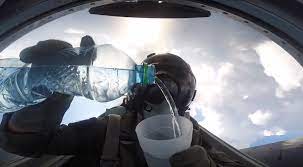
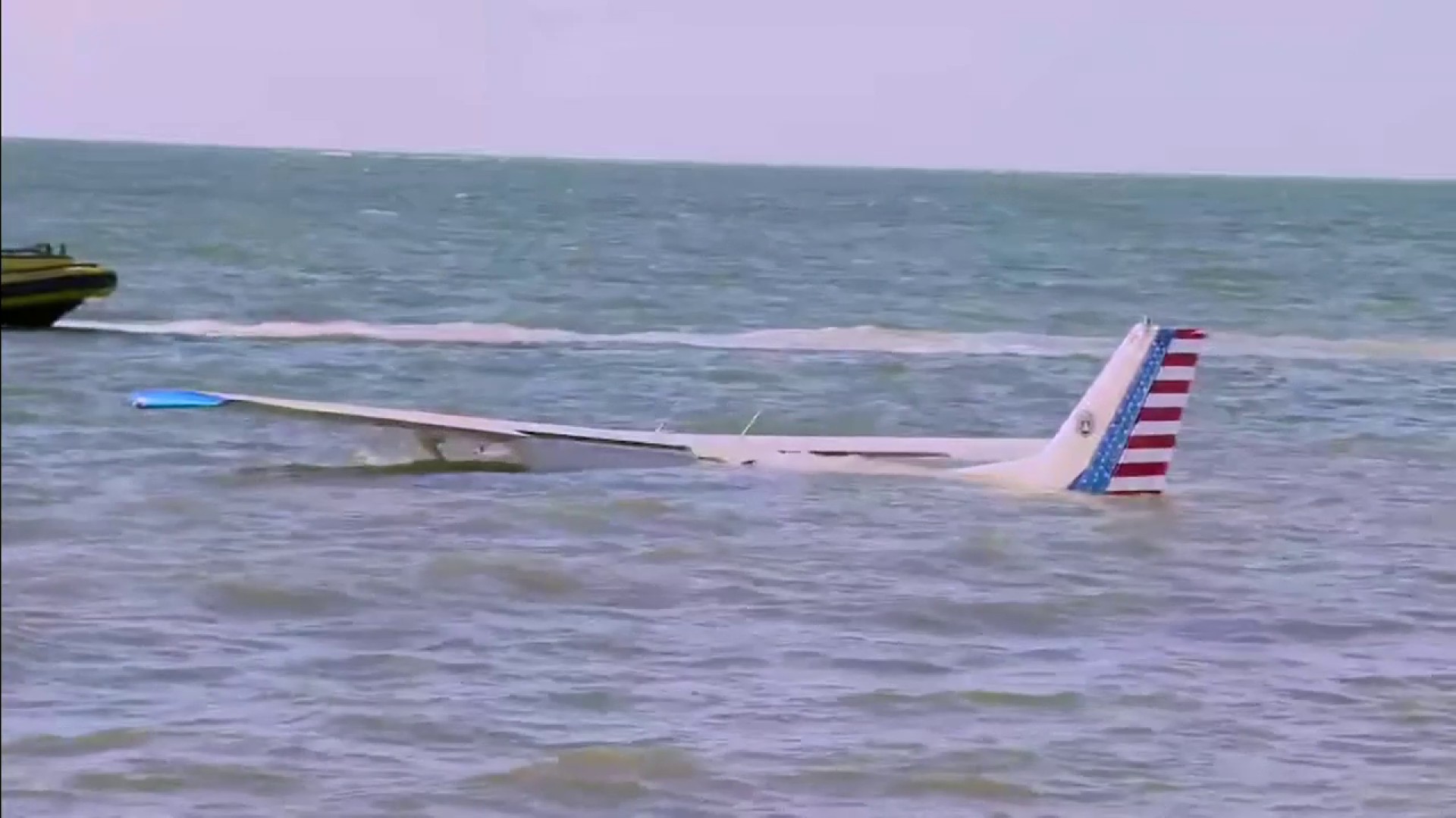
Say, you're a fighter pilot out on an ocean survey in your jet, just pooring yourself a nice old cup of water, when suddenly, due to not having your hands on the control stick, you experience an unplesant, and rather moist surprise; the atlantic ocean surface. How do you go about being located in this increadibly vast ocean?
You can't use a light source, even at night ships have to sail very close to even get a glimpse of this light, in our case this would be akin to hitting a tiny dot, which our planet would become in the night sky once we gain some distance, with a beam telling you the time it took, you'd have to calculate the changing angle with respect to the planet's rotation and the position, which is just not reliable, and very heavy handed.
You can't reliably use a radio, or a similar communication device, as most of your equipment has probably sank deep down in the atlantic by now. Well, the solution to this problem was actually soundwaves, and three points along the american coast that could pick these up. You see in the ocean, there are different temperatures, and as a rusult dencities, of water. You have some areas with pretty drastic temperature jumps, called thermoclines, and the deepest one of these is called the SOFAR channel.
SOFAR is special, becaue it is the area where sound moves the slowest in the ocean, because of this it also has a very special ability; where noise from the rest of the ocean doesn't really get in, and sound inside doesn't really get out. So a soundwave in here would be able to travel uninterupted for very large distances. Though, how do you send a signal through this channel, when it lies at a depth of about 1000m? The answer is an explosive device, which is buoyant at this particular depth.
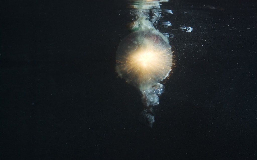
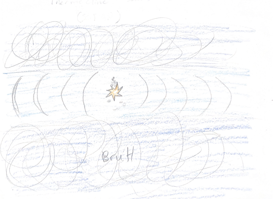
As the pilot, you'd drop this device and sit and wait for a rescue. When the device reaches the desired depth, it would detonate and send out the disk-like soundwave. Next, the towes along the coast of the mainland will be recieving this soundwave. What are we going to do with a soundwave though, it doesn't exactly carry a lot of information. Well, one or two towers wouldn't do us much good in finding the precise position, but three towers will let us do so, how come? For this we need to use a consept known as trilateration, which relies on at least three points of reference to determine a signals origin.
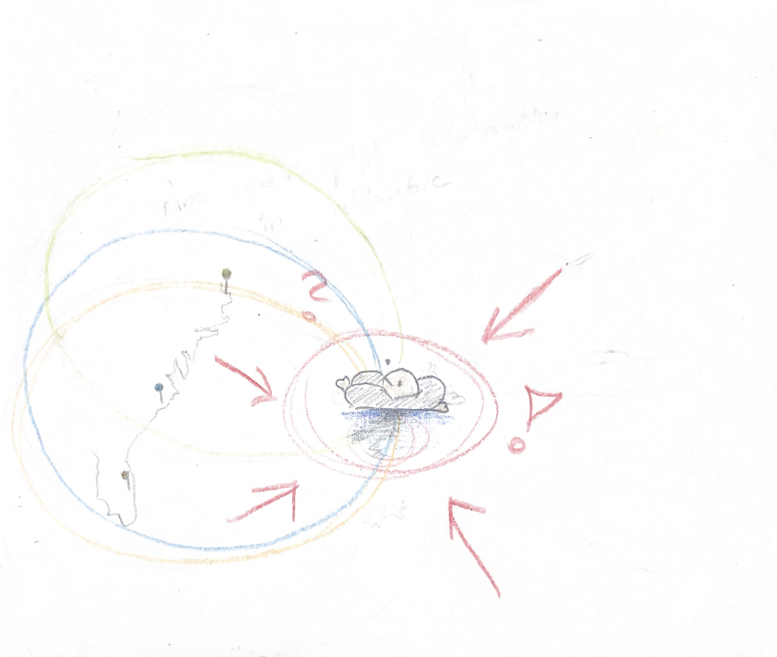
Cause these tree towers along the american coast would recieve the signal at different times, we can compare these differences in time, to make a pretty accurate prediction of where the sound wave came from. A way to think about it is; the towers all start 'sending out' a soundwave with the same difference in time intervals as they recieved. As illustrated to the left, all you have to do from here is see when all three waves intersect at once and you've found your dehydrated pilot.
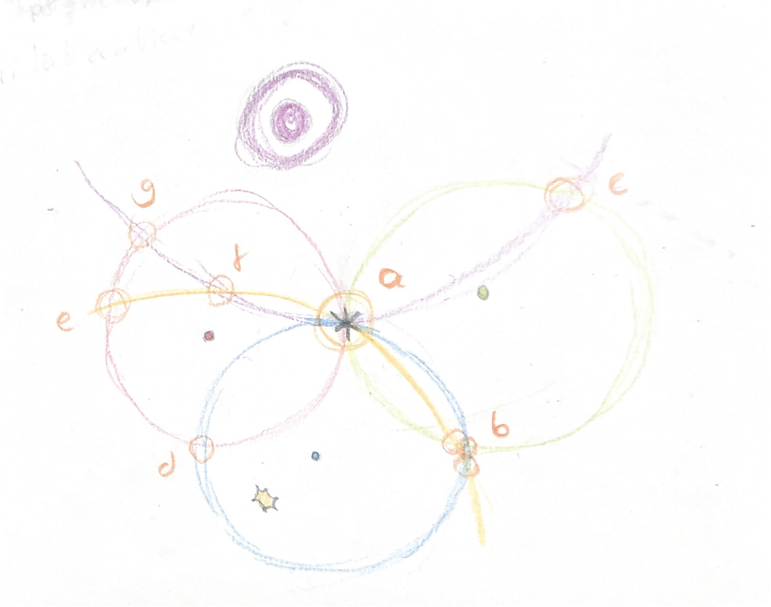
You might start to see where this plays into finding our sattelite position now? We know the distance to each celestial body due to our advanced radar, and using this we can make a spherical shell around the planet with a radius equal to that of our space craft. We'll mostly be traveling in the planet plane so this will be simplified into a circle around the planet, as seen in the imiage to the left here. We also know the planets positions from our numerical methods earlier, namely leapfrog. From this we know where each planet will be at any given point in time. This is the main difference from the previous example, cause our measuring points are in constant motion, does this mean we may have to use more than three of our reference points to get an accurate reading at almost any given time? You see, three points may be sufficient, especially when at rest, but there are a few instances where three points will give you more than one viable position, when looking at our planets, for instance point b in the imiage. Hence, why we opt to use four reference points in order to make the approximation slightly more reliable. Of course you can have instances where the planets are alligned, and you'll get two equally viable positions, no matter how many bodies you throw into the mix, given they're all alligned. This, however, is increasingly rare, and on the off chance it were to happen you can just look at radings before and after the alignment to determine which point is the correct one, as our spacecraft can't suddenly teleport from one momet to the next. So if both point a and b seem equally viable at a certain timestep, we just need to look where the spacecraft was positioned and headed before this was the case, and from this information deduct what point is the correct one.
When looking at the exact position we're gonna need to use some basic maths revolving around circles. The way we do this is by following the radius of the circle by using: \(x^2 + y^2 = r^2\), x and y being each coordinate along this circle for the appropriate radius. Next we simply check when these x and y coordinates are the most similar. Which is described in detail above. For this comparison, however we will find the method of least squares comes in handy, but we've detailed that before in this post.
Are we able to make our readings more accurate with planets that are closer? Since our radar detects the distance between us and each planet core instantly, it won't be a factor worth considering. But let's say for the sake of argument that it didn't; the farther away a planet is the more it would be able to move during the radar signal's travel time, and the farther away a planet is the more time the radar signal spands travelling. This leads to a huge margin of error which is why the radar has these cool functionalities.

As previously mentioned, we could've used a method revolving around sending information about the sattelites whereabouts back to our home planet through a beam of sorts, this would take the travel time of the beam and the angle in which it hits our planet to determine its whereabouts. The problem with this is you need a way to determine when the signal was sent out and how far the sattelite has moved since it was sent. On top of this where are we measuring from? Since our plnet rotates we need a way to negate or account for this, we'd either need to have multiple measuring points around the planet taking in the signal, recieve one signal per planet rotation or set up a measuring station at one of the poles which would probably have been good prep for our astronauts, come to think of it... Another issue is actually hitting our planet with the signal, since the farther away it is the more accurate it needs to be to even hit the planet, not to mention the measuring points. The trilateration method simply provides a more lenient and convenient solution.